|
Unit 5 -- The Use of Remote Sensing Data to Construct Useful Images -- chapters 5--8
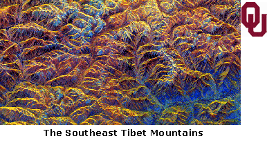
"Most remote sensing images are recorded in digital form and then processed by computers to produce images for interpreters to study."
Summary of Chapters in This Part
As seen in the previous unit, there are many different types of remote sensing. Thermal infrared images are used to record the temperatures of many different types of materials and landscapes. Radar images can be acquired at night and through cloud cover to illuminate a variety a linear features on the terrain, like street patterns, fractures, and faults.
There have been many different satellite radar missions that have proven the importance and usefulness of remote sensing. Each different type of satellite has its own specialty that is able to benefit some of the different applications of remote sensing. The Magellan mission was able to provide information not of our planet but of another, Venus. Other missions have produced geological maps of hard to reach areas, such as rain forests or deserts. Other satellites can take images at steep angles which are perfect for oceanographic observations.
After each image is taken, sometimes in order to better enhance the quality of the image they are put into digital form. This is often done with Landsat images. Digital imaging can compensate for data errors or distortions, and it can alter the visual impact of the image to increase its information content. Digital image is often a very cost effective method to increase the importance of remote sensing image, although digital imaging can be used on any images, not only remote sensing images.
Useful Outside Links, Readings, etc.
A general page that provides links to pictures and descriptions of different places and the reason why they were selected for satellite radar imaging, such as geology, volcanoes, or ecology.
A page that gives some general information about the JERS-1 satellite.
A web page dedicated to RADARSAT-1 that provides facts about the mission and about the satellite itself, plus more fascinating images.
An article describing the necessity for remote sensing radar images in military strategic planning.
A brief article about two digital imaging companies combining and what their digital imaging can do.
A study that is comparing remote sensing imaging to digital imaging and weighing the advantages and disadvantages of each.
|
|