|
Unit 2 -- Natural Hazards
"Remote sensing is becoming increasingly valuable for analyzing, warning about, and assessing damage related to natural hazards."
Summary of Chapters in This Part
Chapter 13
In this chapter, we learn about how remote sensing is being used to prevent and aide in the relief effort of different types of natural disasters. Many types of remote sensing systems ( SPOT, Landsat MSS, Radar Interferograms) can be used to recognize land and undersea active faults and their earthquake potential. It is also used to evaluate the damage caused by earthquakes.
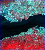
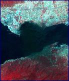
Floods can be monitored with Landsat and radar images. NDVI and AVHRR images are used in identifying images of vegetation that might be prone to forest fire. Landsat and SPOT images have been used to study the morphology, structure, and distribution of volcanoes. Radar images are also used for volcanoes because of their ability to penetrate through clouds, volcanic steam, and ash. Thermal IR images have been used to find areas that might be prone to landslides. Natural disasters can be monitored with the help of remote sensing.
Useful Outside Links, Readings, etc.
A page dedicated to remote sensing imaging of Forest fires. The page gives many good links that either have interesting pictures of SPOT images or articles about organizations who use SPOT images in their data collecting.
An article about how satellite data helped to provide important information to speed up the relief effort after an earthquake in El Salvador.
A general page that provides links to articles or organizations that deal with the remote sensing of volcanoes.
An article about Remote Sensing and its involvement in Flood assessment and prevention
A page that gives a Spot image and information about how to read that image to find out what each different color signifies in a flood that occurred in the Lower Mekong Basin.
|
|