|
Unit 4 -- Understanding Landsat and other Remote Sensing Data
"Remote sensing is defined as the science of acquiring, processing, and interpreting images, and related data, obtained from aircraft and satellites that record the interaction between matter and electromagnetic radiation."
Summary of Chapters in This Part
Chapters 1-5
Remote sensing is the methods that use electromagnetic energy , such as light, heat, and radio waves, as the means of detecting and measuring target characteristics. Remote systems operate in frame mode, which instantaneously acquire an image of an area on the terrain, and scanning mode, which uses a single detector with a narrow field of view to sweep across the terrain to make an image. There are many different kinds of remote sensing techniques.
Some remote sensing methods are very basic. Aerial photographs are often used because of their low cost, excellent spatial resolution, and many types of film may be used for different sensitivity ranges. But, daylight and good weather are necessary for a clear picture. Thermal Infrared images are also used to record the radiant temperatures of materials. They are used to differentiate materials, map surface moisture, and map environmental features.
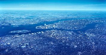
Satellite photographs are also commonly used. The satellites that have become a huge operational system are the Landsat satellites. Landsat is able to provide cloud free images, repetitive coverage of different areas in their different seasons, color images, recognition of major features, and images may be used for computer processing. There are two broad categories of satellites: earth resource satellites and environmental satellites. Earth resource satellites (Spot and Landsat) are designed to map renewable and nonrenewable resources. Environmental satellites cover the earth daily or hourly and provide coverage at oceanic and continental scales.
Useful Outside Links, Readings, etc.
A United States Geological Survey page that contains information about the different types of remote sensing satellite products and a description of each.
An list of satellites links that have been orbited to take images and also the different mission for each satellite and some interesting facts about each satellite.
A brief article from the United States Geological Survey about SPOT imaging.
An page full of links that deal with the Advanced Very High Resolution Radiometer.
A general page about thermal and infrared images, with links and more detailed subtitles.
|
|